

NASA Gravity Map Offers Best Ever Look At Mars
NASA has released an amazingly detailed gravity map of Mars, which shows forces around the red planet and huge amounts of physical properties. This was created using range tracking and Doppler data, collected from three different spacecraft orbiting Mars for over a decade: the Mars Global Surveyor (MGS), Mars Odyssey (ODY), and the Mars Reconnaissance Orbiter (MRO).
Like most planets, Mars has a bumpy surface that affects levels of gravitational pull across all of it. NASA's gravity map plots these fluctuations, to help future spacecraft navigate the fluctuations of flying over mountains and canyons. Creating this map required two years of data analysis and modelling to confirm each painstaking detail.
With both the high and low points in the gravitational field identified around the planet, this allows us to gather huge amounts of detail about the physical features of Mars, such as crustal thickness, seasonal variations, levels of ice at the poles, etc.
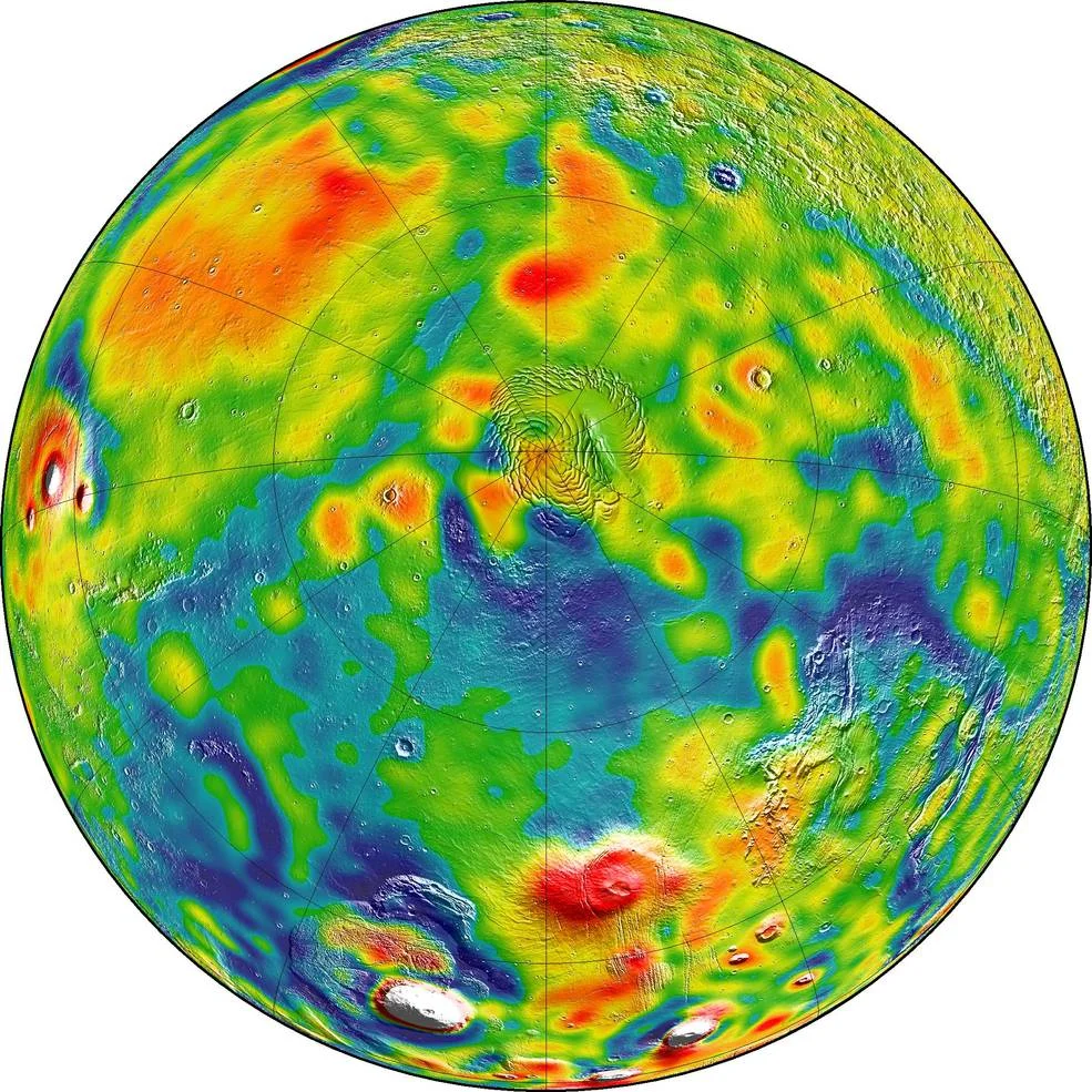
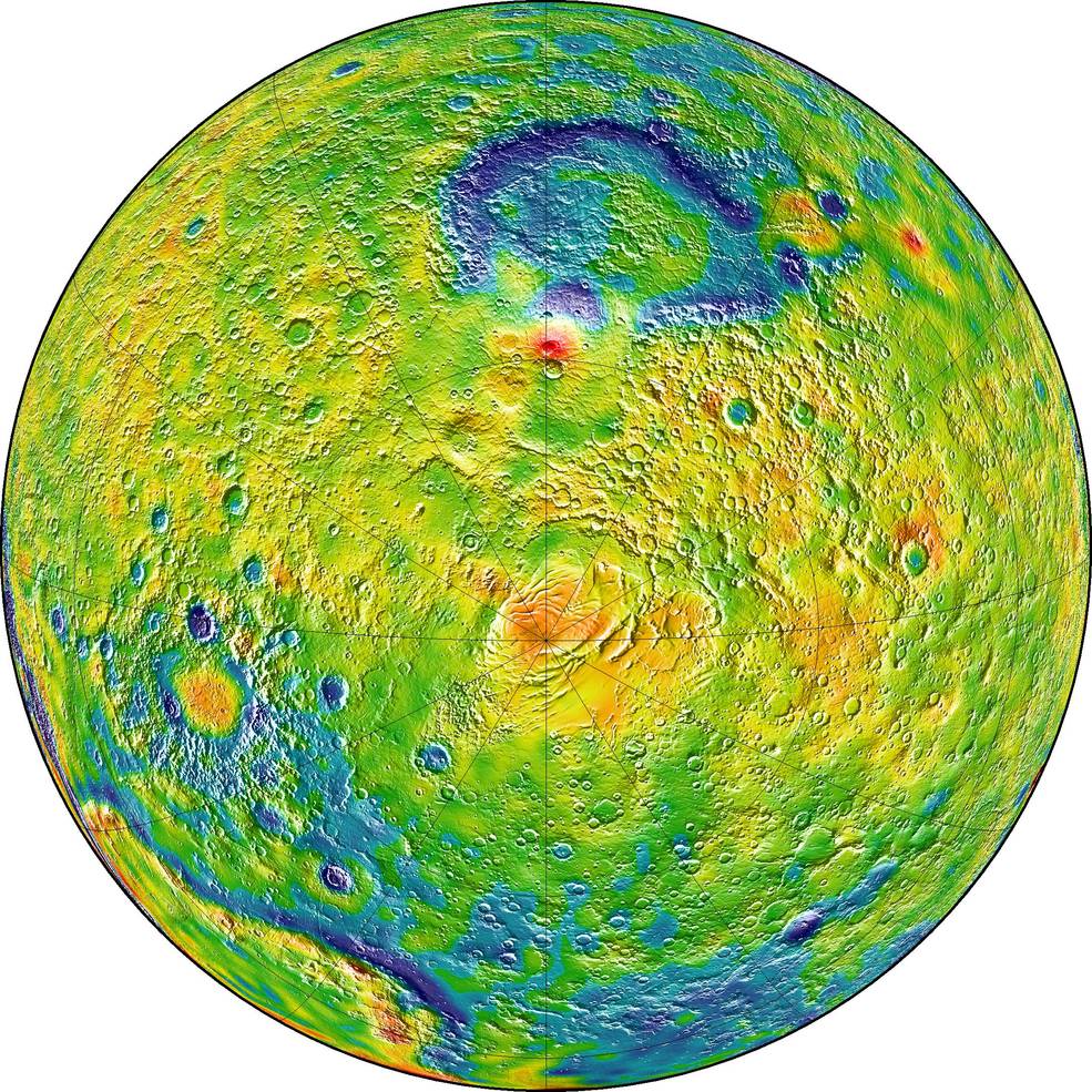
“With this new map, we’ve been able to see gravity anomalies as small as about 100 kilometers (about 62 miles) across, and we’ve determined the crustal thickness of Mars with a resolution of around 120 kilometers (almost 75 miles),” said MIT’s Antonio Genova commented. “The better resolution of the new map helps interpret how the crust of the planet changed over Mars’ history in many regions.” The research team was able to estimate the amount of carbon dioxide that freezes out of the atmosphere during a Martian winter. They also were able to observe the changes in the north and south poles that occurred with the changing of the Martian seasons.


Alongside the scientists, 50% of the British public and the future health of young people across the nation, I have one simple request: delay Freedom Day, please.